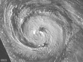
MIAMI, Florida -- Hurricane Bertha, a Category 1 storm, was causing large swells and high surf on Bermuda beaches Friday morning as it crept toward the Atlantic island.

As of 5 a.m. Friday, Bertha's center was about 350 miles (565 kilometers) south-southeast of Bermuda, moving northwest at near 7 mph (11 kph). The storm's maximum sustained winds had decreased slightly to about 85 mph (140 kph) with higher gusts, forecasters said.
The storm is expected to slow down its forward progress and turn toward the north and northeast in the next two days, the hurricane center said."On this track, Bertha will slowly approach Bermuda on Friday and Saturday," the hurricane center said. "Large swells and high surf are affecting Bermuda, and these conditions are expected to persist for the next few days."
The center advised those on the island, a self-governing British colony, to monitor Bertha's progress closely.
Bertha's intensity has fluctuated. At its peak Monday, it was a major Category 3 hurricane with top winds of 120 mph (193 kph). Its wind speed dropped to 75 mph (120 kph), barely hurricane strength, before picking up once again and reaching Category 2 intensity late Wednesday, with top sustained winds of 105 mph (169 kph).
The storm formed July 3 off Africa near the southern Cape Verde Islands.
The first tropical storm of the season, Arthur, formed May 31 near the coast of Belize and dumped heavy rain on Central America and southern Mexico.


.jpg)
0 comments:
Post a Comment